
In the Arctic, the interests of 4 major powers intersect in the Arctic, which is the most prominent presence of a geopolitical presence there, namely: the United States, Russia, Canada and China, as well as the Scandinavian countries. Each of these parties has special strategies and aspirations driven by security and economic considerations.
While all of them participate in realizing the enormous value of the Arctic resources and its marine corridors, its positions vary on how to share influence and wealth in the region. These countries are distributed today among the seven NATO members (the United States, Canada and the five Scandinavian countries), and on the other hand China and Russia.

This new distribution of polar powers has gained special importance after Finland and Sweden officially joined NATO in the past two years, as the alliance has turned into a almost complete polar power that Russia is bound by the north and west, which the Kremlin considers “a direct threat to Russia’s national security.”
While the Arctic region was historically managed with the logic of scientific and environmental cooperation, the balance of the emerging forces warns of eroding this consensus and turning the region into a geopolitical battlefield.
However, these countries are not all coastal countries in the Arctic. Only five main countries surround the waters of the Northern Ocean: the United States, Canada, Denmark (via Greenland), Norway and Russia.

Russia and Canada are on the list of the most important countries in the Arctic, where Russia has the longest coastal line in the Arctic, which constitutes about half of the total polar coast, and approximately 20% of its wild area is within the range of the Arctic circle, and includes major cities and industrial ports, which is a unique geography that gives it a natural preference, and makes it the main polar power.
The Arctic is a basic pillar of the Russian economy, as its resources contribute about 15% of GDP, and constitutes a large percentage of Russian energy exports.
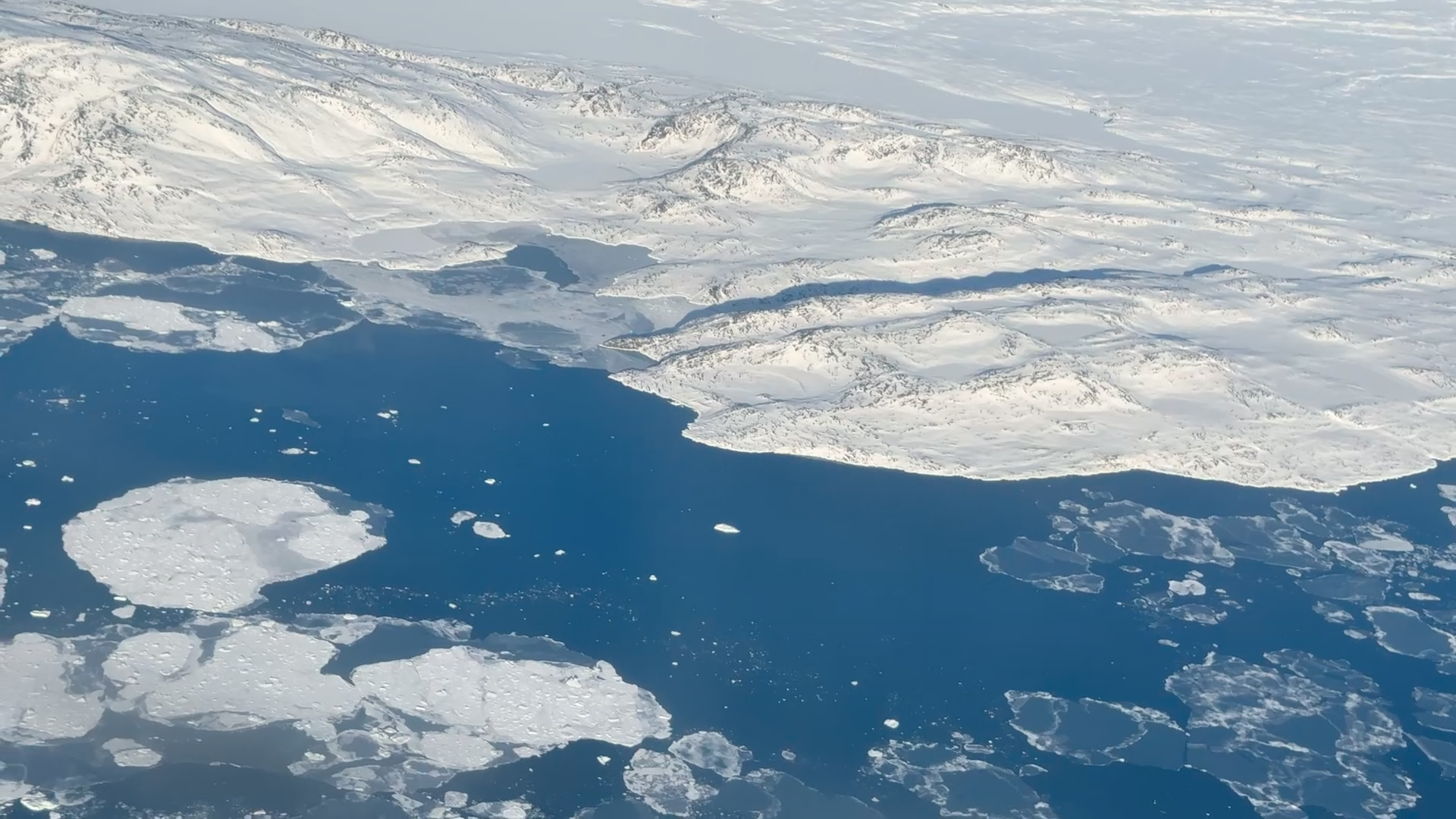
More importantly, the two main naval roads that will allow ships to cross the Arctic along the Russian and Canadian coasts: the northern sea road and the northwestern corridor. The North Sea Road is a more reliable marine commercial road than the northwestern corridor, and it extends along the northern coast of Russia from the Bring Sea to the Parrents Sea.
Moscow has adopted several years ago that mixes the expansion of the infrastructure in the north and focus on consolidating legal demands, as well as intensifying the military presence by renewing the rules some of which dates back to the Soviet era, deploying a fleet of ice souctions, as well as strengthening defensive capabilities along the “North Sea Road”, which extends along the northern coast of Russia from the Bringing Sea to the Burners Sea (as it is Show in the picture above).
This road is a promising economic artery, and Moscow hopes that it will turn into a global commercial corridor, with the imposition of traffic fees and use on foreign ships.
Russia and Canada also have the largest naval fleet equipped to deal with the harsh climate in the Arctic, as Russia has more than 41 ice slots in its fleet, while Canada has about 18 sweeping. By comparison, the United States has only two workforce sweeters, and although it can build more, this may take 5 to 10 years.
In contrast to the early Russian presence, the United States was delayed in the northern pole despite its polar coastal through Alaska. On the course of the Cold War, the American focus was limited to the security side, and its manifestations were the creation of the “DEW” radar system to monitor any potential Soviet attack, while the region’s priority in the American strategy declined after the end of the Cold War, given that it is considered a low -tension area.

But the rapid transformations in the last decade – headed by the Ukrainian war, climate change and the rise of China wishing to influence the polar region – prompted the United States to reconsider its position. The US administration has begun to adopt a new speech describing the Arctic as the “fourth coast of America” that deserves protection and development.
Economically, the “Prodo Bay” field in Alaska is an important pillar in the production of American oil (where it represented 8% of the total US product), while the unexploited reserves make controversy among independence advocates in the field of energy and environmental defenders.
At the military level, the US Department of Defense began to remedy the gap with Russia and China, prompting it to adopt a new strategy in 2022 to enhance polar readiness. But the difference is still big, as America has only two active icebergs, compared to a huge Russian fleet of more than 50 sweeping. Therefore, Washington intensified its cooperation with Canada, and raised the pace of its military maneuvers in Alaska, taking advantage of Finland and Sweden’s accession to NATO, to become part of an alliance that surrounds the pole and enhances its influence against Moscow.
However, there is another extremely important strength that geography gives to the United States in the Arctic; Although Russia appears on the map as if it controlled the region, its vast possessions of the lands there do not help it in dealing with one of its basic strategic weaknesses: its failure to reach the world’s oceans. Russia cannot get out of the Arctic to reach the Pacific Ocean without going through the Chocke Sea and the Beering Strait, both off the American coast of Alaska.
All of these data may be a reason in the statement of US President Donald Trump in his second term with his desire to include Greenland and Canada to become part of the United States, and what this step achieves from American hegemony on the disputed geographical scale in the Arctic, and it will give America a tremendous geopolitical power, which is rejected by Canada and Denmark alike.
The United States may not have many ice souctions, but its other naval forces are very advanced and can easily close this corridor if it decides that this decision is of its national interest. In this case, to get out of the Northern Frozen Ocean to the Atlantic Ocean, Russia will have to cross the water between Iceland and Greenland, or between Iceland and the United Kingdom. These holes are larger than the Beering Strait so far – about 200 and 500 miles, respectively – but are also vulnerable to the siege by the anti -Russian forces, according to the analysis of Giopolitical Futures.

(Tagstotranslate) Policy (T) Dimensions (T) Conflict