
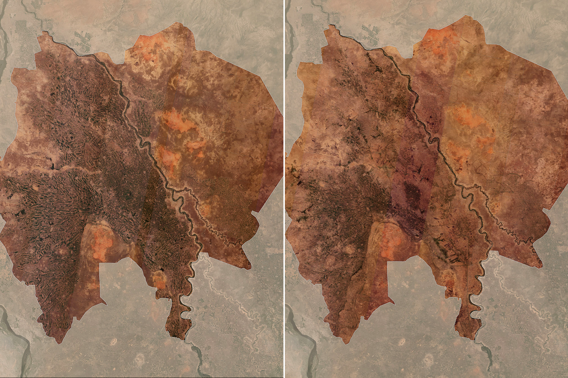
Analysis of satellite images showed a sharp deterioration in vegetation in Gezira State in central Sudan, which is the country’s food basket, as it includes the largest agricultural project in Africa, the “Gezira Project,” which contributes about 65% of Sudan’s cotton production.
The analysis of satellite images extended over a period of 5 years, from 2020 to 2025, as the results of the “Sentinel-2” satellite images revealed the extent of the deterioration of vegetation cover, which reached its lowest levels this year compared to previous years.
The analysis was based on the Vegetation Cover Index (NDVI), which is an indicator specialized in indicating the health or density of vegetation cover for a pre-defined area, as its values range from “1” to “-1”, and the number “1” expresses the highest level of density. And the health of the vegetation cover, while the number “0” indicates its lowest level, and anything below zero is not considered vegetation.
It is noteworthy that in December 2023, the Rapid Support Forces took control of several cities in Al-Jazira State, including Wad Madani, the center of the state, and the Sudanese army announced two days ago that its forces were able to regain control of the city.
The Rapid Support Forces control large parts of the state except the city of Al-Manaqil and its surrounding areas up to the borders of Sennar State in the south, and west to the borders of White Nile State.